Cloudy with showers and possible thunder into early overnight, then a chance for rain showers into morning. Winds becoming NW-N at 5-10 mph, with higher gusts. Temperatures dropping into the mid 50s to middle 60s, coolest at highest elevations.
Sunday Afternoon
Becoming partly-mostly sunny. Cooler and less humid with refreshing air. Winds N-NE at generally less than 10 mph. Temperatures varying from 60s in upper elevations to the mid-upper 70s.
Sunday Night Into Monday Morning
Partly to mostly clear. SE-SSE winds mostly less than 10 mph along mid-upper elevation mountain ridges. Temps varying from mid-upper 40s in cooler mountain valleys to the mid-upper 50s. Areas of fog, especially along lakes and in main river valleys.
Monday Afternoon
Partly to mostly cloudy. Slight chance of a shower or sprinkle. Light SSE-SSW winds. Temperatures varying from low 70s in upper elevations to the lower 80s ( warmer south into the Great Valley ).
Monday Night Into Tuesday
Partly to mostly clear. S-SW winds 5-10 mph, with higher gusts, along mid-upper elevation mountain ridges. Temps varying from 50 to 55 degrees in cooler mountain valleys to the lower 60s. Areas of fog around lakes and rivers.
Weather Discussion ( Warm Trend )
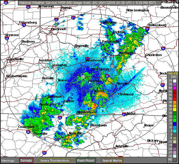
A cold front featuring scattered showers and local downpours will continue passing across the mountains Saturday night into Sunday morning.
Doppler Radar At 9:29 PM Saturday – September 10, 2016
A cooler, refreshing air mass follows during Sunday into Sunday night-Monday morning with another taste of early autumn in the mountains.
European 51-Member Ensemble MEAN 500 MB Height Anomalies – DAYS 3 to 7
Nothing has changed in the big picture from my previous outlook, with MEAN 500 MB Heights continuing to run above average with ridging over the southeastern USA ( above ) during the bulk of this coming week.
European 51-Member MEAN 850 MB Temp Anomalies – DAYS 3 to 7
Following cooling felt in the short-term this will return and continue the above to much above average temperature trend observed so far in September ( especially by day ).
Although the mountains will not reach 90 degrees, the Great Valley will have a chance to pad the all-time record number of 90 degree days now observed in the Tri-Cities.